By Frank Strait
Severe Weather Liaison
S.C. State Climate Office
Saturday night’s storms were quite damaging and caused about 150,000 electric customers in the state to lose power. Our second round earlier today wasn’t as robust but still caused wind damage in some areas. The worst of it was in Greenwood, Newberry and Saluda Counties. Power has been restored for nearly everyone as of this evening … for now. Monday is going to be another stormy day.
Monday’s round will be more like a 1-2 punch. The stationary front partly responsible for thunderstorms earlier today and Saturday night will retreat northward tonight into Monday morning as a cold front now over the Midwest and Plains states approaches. The retreating warm front will generate spotty thunderstorms Monday starting by midday in the Lowcountry, and during the afternoon farther north; that’s Punch One. The storms will be capable of causing locally damaging wind, and an isolated tornado or two can’t be ruled out.
Punch Two comes from the cold front moving in on Monday night. Thunderstorms ahead of the front will pop long before the front gets to South Carolina, and they should merge into a squall line before reaching us. Squall lines are usually damaging straight-line wind producers, and we typically don’t see many tornadoes with them. However, the tornado risk will be non-zero with Monday night’s storms, and damaging wind could be more widespread if they arrive early enough while it’s still warm and unstable.
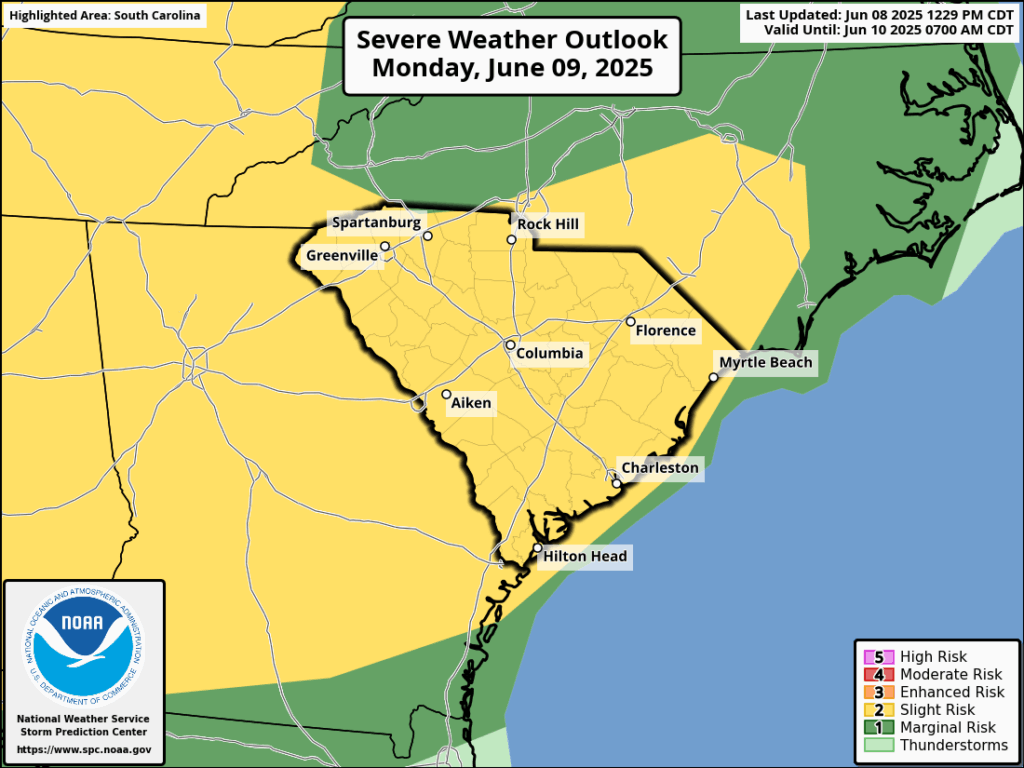
The Storm Prediction Center outlook for Monday spans both events and has virtually the entire state in a level 2 of 5 risk area.
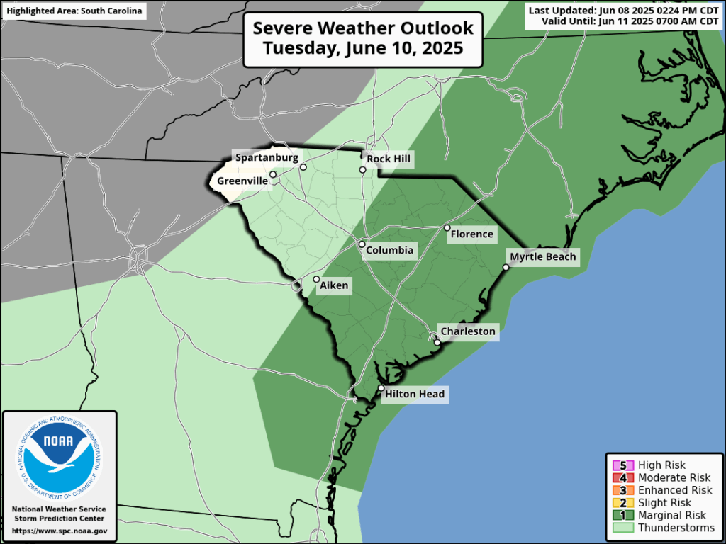
The front will turn stationary near the East Coast on Tuesday, and it will cause more spotty thunderstorms. However, the setup isn’t as good for severe weather, and only the strongest storms will cause locally damaging wind. So, SPC only has the Coastal Plain at risk for severe storms in their outlook for Tuesday.
Wednesday could end up like Tuesday, but with afternoon thunderstorms mostly confined to the area east of I-95. So, most of the state will have tranquility that day. However, what remains of the front should retreat northward on Thursday, so we will likely turn more active again at the end of the week. However, the severe storm risk on Thursday and Friday looks no more serious than with routine summertime afternoon thunderstorms.
We’re not expecting tornadoes all over the place on Monday, but you’ll want to be prepared in case a few occur and one happens to target your area. Review tornado safety tips and have a sheltering plan ready in advance.
My baby watch remains in effect, but there is no baby warning yet.
WEATHER: State Will Have One More Round of Severe Storms Monday