By Frank Strait
Severe Weather Liaison
S.C. State Climate Office
For a change, there is a little weather excitement to outline today. A cold front now over the Mississippi and Ohio Valleys is moving our way, bringing rain and thunderstorms, mainly to the Upstate. The front will usher in colder air starting Sunday into Monday.
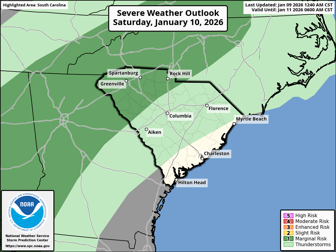
An area of rain and thunderstorms will reach the Upstate this afternoon, primarily affecting the I-85 Corridor and points to the northwest. The rain could become heavy enough to cause isolated flooding in the far northwest, despite the ongoing drought in the area.
The stronger storms moving through Saturday might cause locally damaging winds, and there is a risk of an isolated tornado or two.
In addition, it looks like winds will pick up early Saturday and remain gusty through the day, especially over the northern half of the state, with peak gusts around 35 mph. Motorists and pickleballers beware! Look for a wind shift late Saturday behind the front, and it remains breezy through Sunday.
While the severe storm threat drops to near zero as the front reaches the I-20 Corridor during the evening, that area and points south will see a scattering of showers as the front moves through Saturday night.
Colder air will move in behind the front Saturday night into Sunday. We will return to the reality of midwinter by Monday as temperatures running around 20° above average through Saturday shift to 4-8° below average on Monday.
High pressure keeps us tranquil and seasonable for Tuesday, then another cold front moves in on Wednesday. It is at this point that our forecast becomes complicated. We’ll enter a weather pattern that permits a winter storm to occur in South Carolina late next week. It will be the ol’ western North America upper ridge, eastern North America upper trough; the negative NAO, positive PNA combo that geeky snow lovers rave about.
One model (the GFS, the one whose output you take with the biggest grain of salt) has suddenly jumped on the idea that a storm blows up on our coast Thursday as fresh cold air blasts in, and the model throws down snow over nearly the whole state. Sus, as the young folks say these days. Other models show not much happening other than a solid blast of cold arriving Wednesday night and maybe a few showers.
However, the cold could still be entrenched when the next storm in line arrives around next Sunday. No promises, snow lovers, but I think our odds are better next weekend than later next week.
WEATHER ALERT: Thunderstorms Saturday, Then Colder