

By Frank Strait
Severe Weather Liaison
S.C. State Climate Office
First, I’ll sympathize with those affected by this weekend’s wildfires. I have an elderly aunt who lives near Myrtle Beach and narrowly missed having to evacuate due to the Carolina Forest Fire. I’m glad she’s OK, besides having to live with smoky air. I encourage y’all to help your fellow South Carolinians if you have the resources.
However, I’m writing today to let you know that we still have a severe thunderstorm risk coming up. The cause is a storm currently over the western part of the country, which will track toward the Great Lakes and pull a cold front through the Southeast this week.
The cold front will cause thunderstorms as it crosses South Carolina late Tuesday night and Wednesday. As the storms blow through, we’ll have a risk of locally damaging wind and isolated tornadoes. The storms likely reach the Upstate by 3-4 a.m. and push offshore by early afternoon.
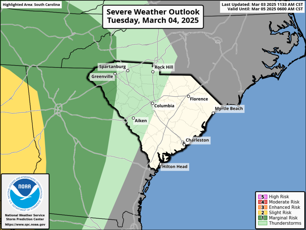
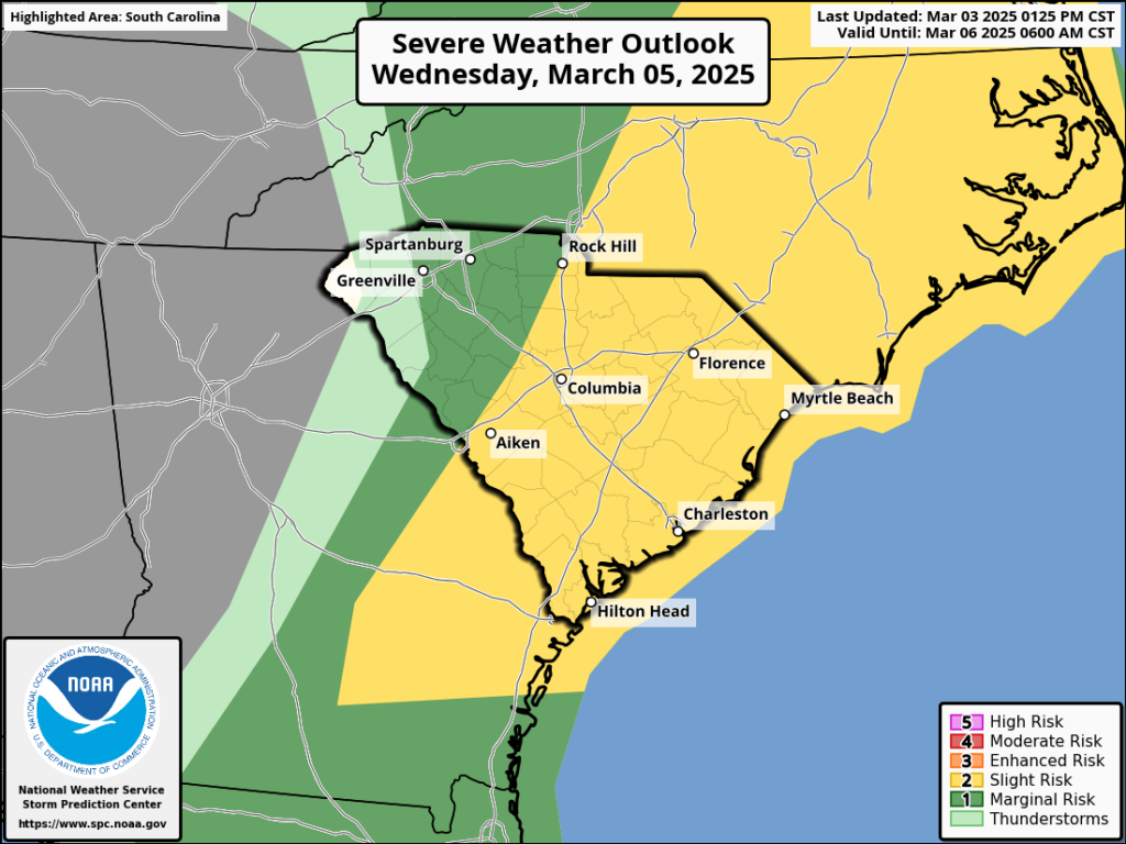
Here are the Day 2 and Day 3 Severe Weather Outlooks from the Storm Prediction Center, covering Tuesday and Tuesday night, and Wednesday and Wednesday night.
In addition to the severe storm threat, we’ll have gusty winds even outside of thunderstorms ahead of the front and in its wake. There will be a lot of wind energy associated with the front. You’ll notice the wind pick up Tuesday afternoon and evening (oh, I’ll be playing pickleball Tuesday evening; that will be a comedy of errors), and it will get increasingly gusty into Wednesday as the front approaches. Gusts may reach 40 mph before the storms; it’s not fun if you have a road trip planned. Behind the front and its storms, the wind remains strong and gusty as it shifts from south to west; gusts may again be in the 35-40 mph range.
So, be on your toes late Tuesday night and Wednesday as the front moves through. It looks like lousy travel weather (gusty crosswinds and rain for motorists) if nothing else, but the threat of severe storms is real. We will likely see locally damaging straight-line winds, but the tornado risk is less certain. The tornado risk will be higher if it gets warmer than expected ahead of the front. That it looks like the front will move faster and arrive sooner than earlier thought helps; the front moves through most of the state before we get to the warmest and most unstable part of the day.
I’ll have an update sometime Wednesday, but it’s not too early to prepare. For example, you can review your severe weather action plan and ensure you know what to do and where to go should a tornado warning come out for your area. We all get a little rusty with things like this when we haven’t had to use the knowledge for a while. As always, you can find help with severe thunderstorms and tornado prep from SCEMD and the National Weather Service.
WEATHER ALERT: Severe Storm Risk Late Tuesday Night and Wednesday


