

By Frank Strait
Severe Weather Liaison
S.C. State Climate Office
Key Points:
-Erin is now a hurricane and is likely to become a major hurricane by Saturday night.
-The forecast track calls for it to be well east of North Florida by Wednesday morning, with computer models mainly calling for a track well east of South Carolina Wednesday night into Thursday.
-If the forecast is correct, we will see no direct impacts from Erin. However, Erin will send large ocean swells into our coastal areas, resulting in dangerous surf with a high rip current risk for beachgoers, and rough seas for those boating on our coastal waters. Some beach erosion and overwash will be possible as well.
-Erin has strengthened into a hurricane. It’s our first hurricane of the season and steaming through the eastern tropical Atlantic today, northeast of the Leeward Islands, and is the only tropical cyclone we have to track. The forecast from the National Hurricane Center calls for Erin to follow a curving path that takes it northeast of the Bahamas during the first part of next week.
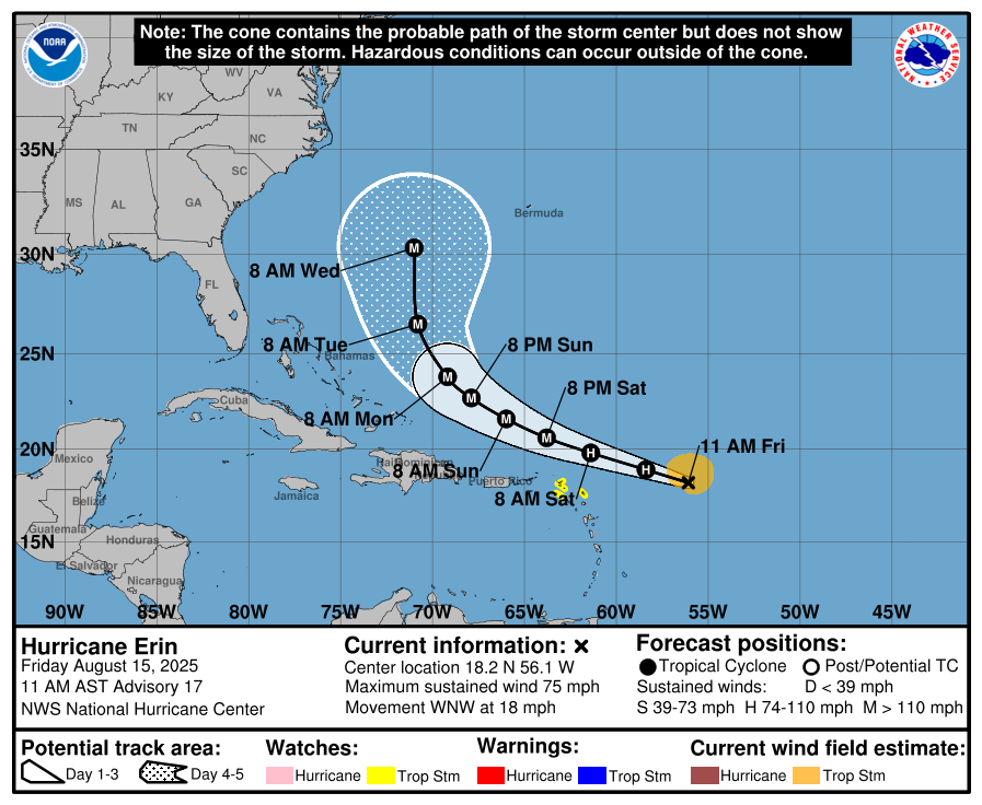
The NHC forecast only goes out to Wednesday, but it implies that Erin will stay well to our east. Computer model guidance that goes out well past Wednesday is in good agreement that the storm will track between Bermuda and Cape Hatteras later next week. However, there remains some uncertainty. A handful of model ensemble members (mainly the newfangled AI-based ones) show a track far enough west for Erin to cause some direct impacts to South Carolina. But right now, the confidence level is about 80 percent that Erin will track far enough to the east that the storm’s wind and rain will remain offshore.
That’s good because NHC is calling for Erin to be a Category 3 hurricane while passing between the uprights next week. That makes sense because Erin will find increasingly warmer waters as it moves to the area north of Hispaniola, and the vertical shear that has been plaguing it should relax. Hopefully, the forecast works out and we’ll breathe a sigh of relief watching it march through the Atlantic next week.
However, Erin will still bring some coastal impacts even if it stays well offshore. Erin will generate large ocean swells that will crash into our coast starting Tuesday. That means we’re likely to have dangerously rough surf and a high rip current risk at our beaches Tuesday through Thursday next week. The swells will make it rough on our coastal waters as well. So, if you have a beach or offshore boat trip planned next week, Erin will affect you.
Also, if you’re visiting North Carolina’s coast next week, especially the Outer Banks, you’d better watch Erin closely. Since that area sticks out into the Atlantic more, a more leftward track of the storm would be more likely to cause impacts there. The same applies if you’re going to Bermuda, as Erin would have more impacts there if the track is more to the right than it looks now.
There are other features over the Atlantic to monitor. Tropical waves are along 83° west over the western Caribbean Sea, 70° west over the eastern Caribbean, 35° west over the middle of the tropical Atlantic, and along 20° west, having just emerged from West Africa. Of these, the one over the far eastern Atlantic is the only one of concern. Dry air over the region and cool waters will likely prevent development for the next 3-5 days. After that, it will be something to watch, and some computer models show it in a position to threaten us in about 10 days.
Also, a disturbance over the western Gulf of Mexico is moving into Mexico and Texas. It looks like it will run out of time over water before it can develop, but Mexico’s Tamaulipas state and much of Texas will get soaking rains from this feature. Finally, we have the remains of an old front off our coast and an upper-level disturbance perturbing it today. An area of low pressure is forming east of the Outer Banks, which will need to be monitored for potential tropical development. We might eventually see Erin gobble up this feature next week, or it might slip away to the northeast ahead of it.
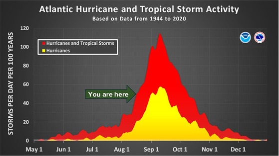
‘Tis the season for active tropics. Erin, we hope, turns out to be a warning shot, but we’re just now starting the typically most active part of the hurricane season, which will last through mid-October. You want to make sure you have your storm preparations in place. If you need prep advice, visit hurricane.sc.
Our weather looks typical for mid-August as we go through the weekend and Monday. This afternoon brings us highs in the low to mid-90s across the state, and a weak front moving in from the north will result in more widespread thunderstorms than usual this afternoon and tonight. The front will serve to knock our temperatures down by just a couple of degrees for Saturday, and we should again see good coverage of afternoon thunderstorms along the coast. Sunday and Monday should bring us temperatures ticking upward again, with less widespread afternoon thunderstorms.
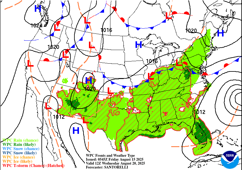
By the time we get to Tuesday, an upper-level trough settling into the eastern part of the country (the feature that should keep Erin away to our east) will bring us a slight reduction in temperatures again. There are some questions about how widespread our afternoon thunderstorms will be. Sinking air usually surrounds big hurricanes, and if Erin is close enough, our afternoon thunderstorms will be suppressed. If Erin passes more toward Bermuda, then we’ll see the usual scattering of afternoon storms. Of course, if Erin gets much further west than expected, then our coastal areas would see some wind and rain starting around Wednesday.
We’re likely to see another cold front move in later next week to cause a stretch of wetter and cooler days. It won’t be as cool as we saw earlier in the month, but our highs will likely only reach the lower 80s across the north and upper 80s in the
 Lowcountry.


