

From The S.C. Climatology Office
By Frank Strait
Severe Weather Liaison
S.C. State Climate Office
We’re finally rid of Debby, but not after the storm threw one more uppercut at the Lowcountry this morning, as heavy thunderstorms dropped another ton of rain in a band stretching from near Smoaks to Georgetown. Up to 10 inches fell, so flooding in the area is severe.
That should be the last of Debby’s effects as the storm is now swirling through Pennsylvania, bringing flooding and tornado risks to the people up north. Behind Debby, a “not as hot front” is moving through the southeastern states.
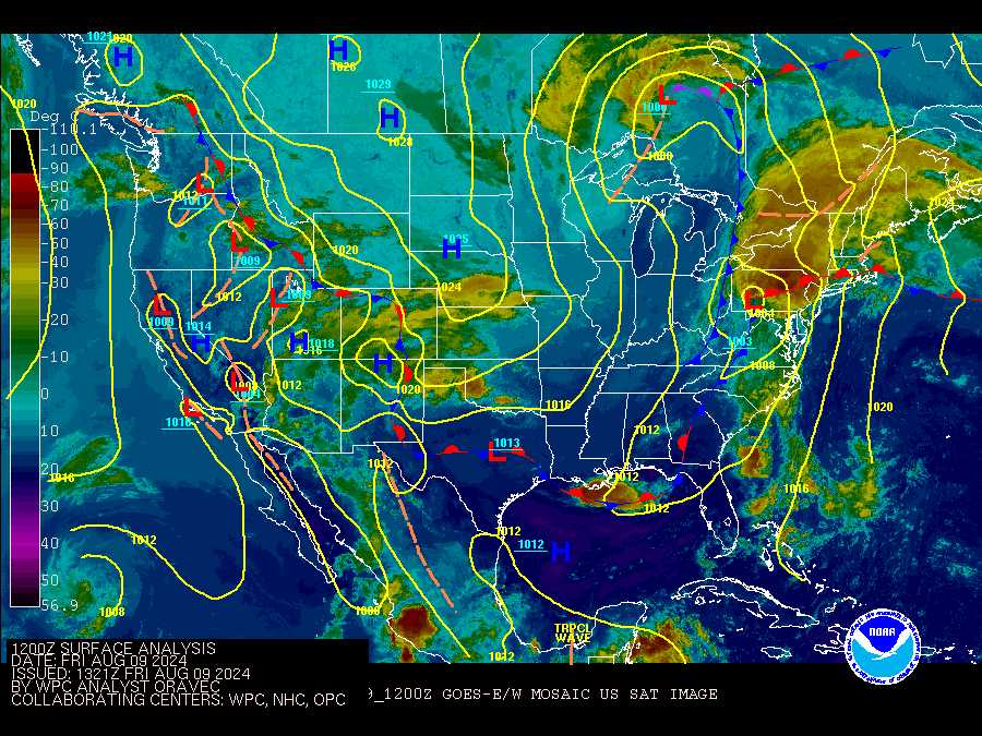
Unfortunately, this front will become stationary along our coast and trigger more thunderstorm activity. So, look for widespread afternoon and evening thunderstorms, especially along our Coastal Plain and adjacent areas of South Carolina over the weekend. Downpours on the soggy soil in this part of the state can result in flash flooding. After a less active day on Monday, a reinforcing front will move in on Tuesday to bring more widespread storms again. At least we will keep the heat in check, as temperatures will be near typical mid-August levels this weekend and a bit below average next week.
The primary problem for the coming days is going to be river flooding. The rain dropped on us by Debby wasn’t as extreme as feared, but it was still tremendous, and we’ll be dealing with runoff for a while. Moderate to major river flooding is forecast for most rivers along our Coastal Plain. Those rivers are slow to fall, so we will deal with the flooding for days as flows come in from the tributaries, other regions of South Carolina, and North Carolina.
Meanwhile, we’ll be watching the tropics. Debby is only the opening volley of a period of more active times in the tropical Atlantic. We’re entering a brief lull in the action. However, a tropical wave moving through the middle of the tropical Atlantic will become a development candidate when it reaches the Lesser Antilles next week.
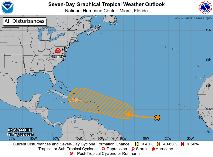
indicates a 60% chance that a tropical wave over the Atlantic will develop
in the vicinity of the Leeward Islands next week.
So, this will become something to watch next week. However, computer models generally agree that an upper-level trough along the East Coast will steer that storm northward over the western Atlantic. That’s good to see, but we’re far enough out that we can’t promise it won’t get near South Carolina or even affect us.
As I’ve mentioned a few times recently, the Madden-Julian Oscillation (more on the MJO if you’re new here) is becoming increasingly favorable for tropical cyclone activity in this part of the world. So, the Atlantic tropics will likely stay active through the end of August and maybe into September before the MJO’s progression brings conditions that suppress thunderstorms and tropical cyclones back to this part of the world.
That being said, even with an unfavorable MJO, you still can see developments in September because it’s hard to keep the lid on the boiling pot that the Atlantic usually is during the peak of hurricane season.
So, it’s important to maintain your readiness this time of year. That’s easier said than done since we just took a hit. However, you have some time because even if the feature of interest in the Atlantic were to come our way, it’s at least a week from bothering us. You have some time to restock. As always, if you need storm prep advice, the lights are always on over at hurricane.sc.
WEATHER ALERT: Debby Is Gone, What’s Next?
The National Hurricane Center's Tropical Weather Outlook from this morning
indicates a 60% chance that a tropical wave over the Atlantic will develop
in the vicinity of the Leeward Islands next week.


