Atmospheric and oceanic conditions have set the stage for an extremely active hurricane season that could rank among the busiest on record. With the peak of hurricane season quickly approaching, NOAA’s National Weather Service urges everyone to know their risk; prepare for threats like damaging winds, storm surge and inland flooding from heavy rainfall; and to have a plan if asked to evacuate.
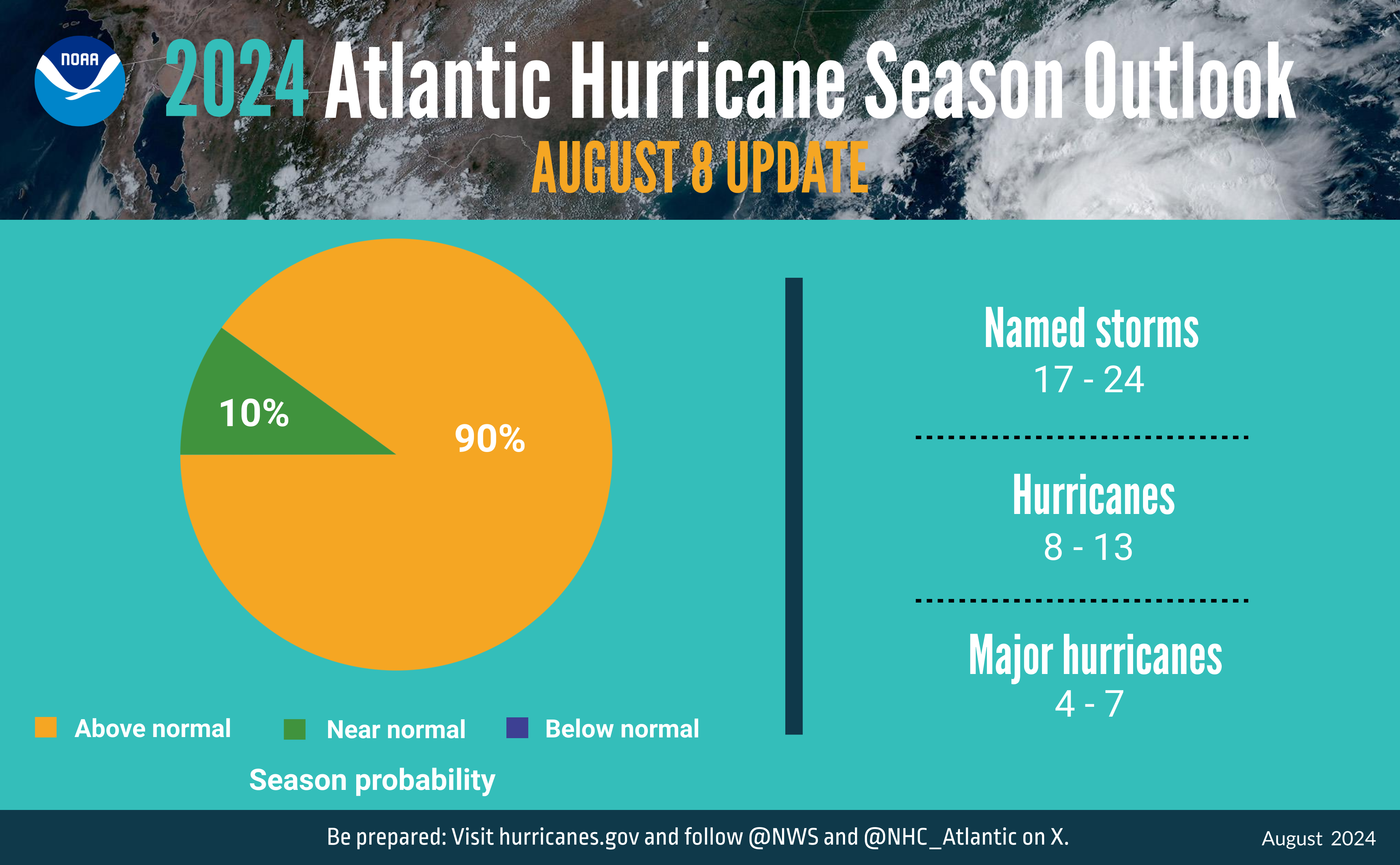
In their routine mid-season hurricane outlook update, forecasters from NOAA’s Climate Prediction Center updated the number of expected named storms to 17-24 (with winds of 39 mph or greater), of which 8-13 could become hurricanes (winds of 74 mph or greater), including 4-7 major hurricanes (winds of 111 mph or greater). This updated outlook is similar to the initial outlook issued in May; it includes totals for the entire six-month hurricane season, including the 4 named storms (2 tropical storms and 2 hurricanes) to date.
Hurricane season runs from June 1 through November 30.
“The hurricane season got off to an early and violent start with Hurricane Beryl, the earliest category-5 Atlantic hurricane on record,” said NOAA Administrator Rick Spinrad, Ph.D. “NOAA’s update to the hurricane seasonal outlook is an important reminder that the peak of hurricane season is right around the corner, when historically the most significant impacts from hurricanes and tropical storms tend to occur.”
In the Atlantic basin, a typical season will yield 14 named storms, of which seven become hurricanes and three become major hurricanes. Atmospheric and oceanic conditions continue to support an above-normal 2024 Atlantic hurricane season, with a 90% probability of this result. 2024 has only a 10% chance of a near-normal season and a negligible chance of a below-normal season.
The 2024 Atlantic hurricane season has already brought significant impacts:
Tropical Storm Alberto formed on June 17, and over the following days it brought nearly a foot of rain to parts of Texas and New Mexico, triggering flash flood emergencies.
On July 1, Hurricane Beryl became the earliest category-5 storm on record in the Atlantic basin. Beryl caused catastrophic damage and approximately 20 fatalities in several islands in the Caribbean Sea, with an additional preliminary death toll of about 25 people in Texas, Louisiana and Vermont.
“Hurricane Beryl broke multiple long-standing records in the Atlantic basin, and we’re continuing to see the climatological hallmarks of an active season,” said Matthew Rosencrans, lead hurricane season forecaster with NOAA’s Climate Prediction Center. “Sea surface temperatures remain abnormally high, and La Nina is still expected to emerge during the hurricane season, so the time to prepare is now.”
Factors that could influence this year’s forecast
The Atlantic ocean basin is expected to be remarkably active due to several factors:
Warmer-than-average sea surface temperatures in the tropical Atlantic Ocean and Caribbean Sea.
Reduced vertical wind shear.
Weaker tropical Atlantic trade winds.
An enhanced west African monsoon.
These conditions are expected to continue into the fall. Of note, the dry Saharan air that prevented tropical storm development during portions of the middle of the summer is expected to subside in August.
Potential climate influences
An ongoing climate factor in the Atlantic basin is the continued warm phase of the Atlantic Multi-Decadal Oscillation, which reappeared in 1995 and has been favoring more active hurricane seasons ever since. Another factor this year is the possibility of La Nina developing in the coming months. Indicative of cooler-than-average sea surface temperatures in the equatorial regions of the eastern Pacific Ocean, La Nina can further weaken the wind shear over the Atlantic Basin, which enables storms to develop and intensify.
About NOAA’s Hurricane Season Outlook
NOAA’s Hurricane Season Outlook is for overall seasonal activity and is not a landfall forecast. Landfalls are largely determined by short-term weather patterns, which are only predictable within about a week of a storm potentially reaching a coastline. NOAA’s National Hurricane Center provides tropical weather outlooks out to five days in advance, provides track and intensity forecasts for individual storms and issues watches and warnings for specific tropical storms, hurricanes and the associated storm surge.
Stay informed: Consult the National Hurricane Center website, hurricanes.gov, for the latest about tropical storm and hurricane activity in the Atlantic and Pacific Ocean basins. You can also follow updates from NHC on X at @NHC_Atlantic.
SHOWN ABOVE IS A summary infographic showing hurricane season probability and numbers of named storms predicted from NOAA’s update to the 2024 Atlantic Hurricane Season Outlook. (Image credit: NOAA)


