By Frank Strait
Severe Weather Liaison
S.C. State Climate Office
Good morning and welcome to 2026. I hope y’all had a grand New Year’s celebration with your friends and family. I know some of y’all did because driving home from my girlfriend’s house during the first minutes of the year, it sounded like Colonel Sumter’s men were driving the British out of Columbia’s Rosewood neighborhood.
This morning, a storm centered over the southern Plains is moving our way, bringing us some needed rain over the next 36 hours. The rain will reach the northwest later this evening and spread over the state through Saturday morning. While the entire state will see some rain, the southern part will get more than the northern part.
Meanwhile, a cold front to our north and west will shift southward and send chilly air into the northern part of the state. That will keep the Upstate, Catawba region, and upper Pee Dee in the upper 40s and low 50s, while the Lowcountry sees highs in the 60s.
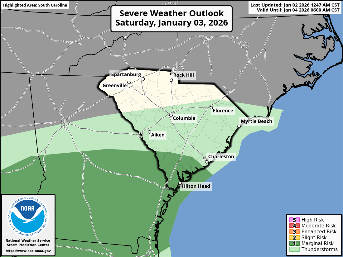
The warm air over the southern part of the state will be conducive to thunderstorms rumbling through during the afternoon and early evening. A part of the Lowcountry will be at risk for seeing an isolated severe storm.
This storm system will move out Saturday evening, with dry and seasonably cool air pushing in behind it. Sunday may start with lingering low clouds and fog, but it’s likely to be sunny across the state by the afternoon with highs in the mid to upper 50s from north to south.
Monday also looks dry, with high pressure centered over New York controlling our weather. Highs will range from the mid-50s north to the lower 60s south.
That area of high pressure will slide eastward on Tuesday, and southerly to southwesterly winds around the departing high will give us a warmup. Temperatures will run well above normal again on Tuesday through at least Thursday. We’ll see highs in the 60s on Tuesday, upper 60s and lower 70s on Wednesday, then most of the state will reach the 70s on Thursday. Tuesday and Wednesday should feature plenty of sun, but clouds will stream in on Thursday ahead of our next cold front.
Computer models show varying ideas about the front coming our way late next week. It could move in on Friday and become stationary through next weekend, or it could stall to our northwest and not move through until Sunday. So, there is a lot of uncertainty about what the weather will be like during that time. Once that front finally pushes through, we’re likely to see a period of colder-than-average weather.
This week’s Drought Monitor indicates an expansion of drought conditions since last week.
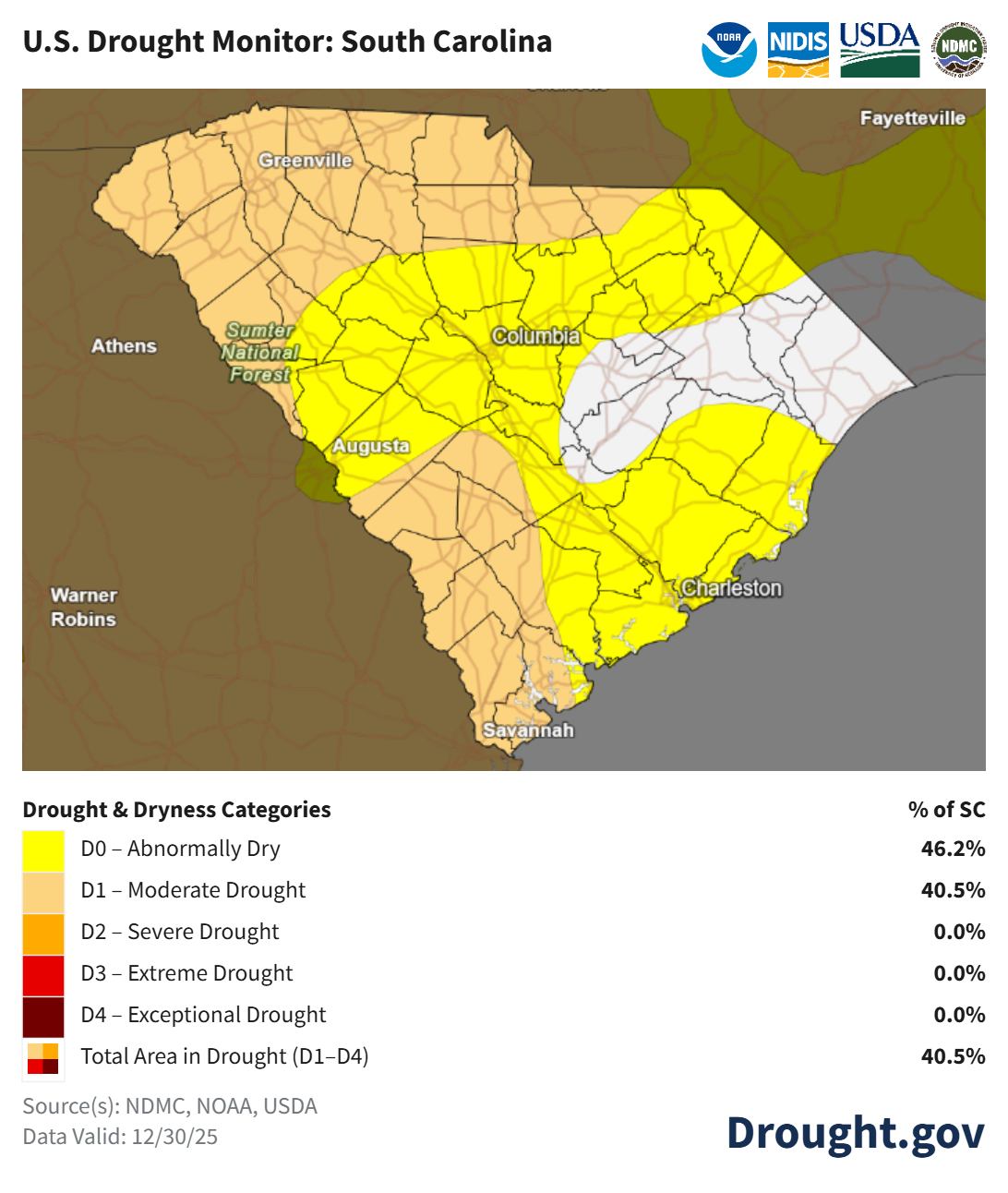
Rain coming through Saturday will help, but won’t get rid of the drought entirely. Another dry spell Sunday through at least Thursday will not help matters. The setup for next Friday and next weekend has a chance to bring us substantial rainfall, but don’t get your hopes up because most computer models do not show us seeing a soaking.
WEATHER ALERT: Needed Rain Coming Tonight and Saturday